
Option 1: PC version
The official web version of Google Card includes not only the functions of building routes, but also the possibility of viewing panoramas. Street viewing mode works almost for all regions, but in small settlements there is a possibility of presence of obsolete panoramas.
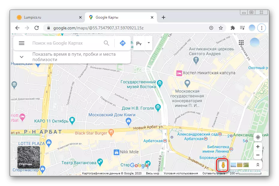
- Go to Google Maps website and select the area to view panoramic views.
- When the map is scaling at the right side of the screen, the "Street" mode icon appears in the form of a yellow figurine.
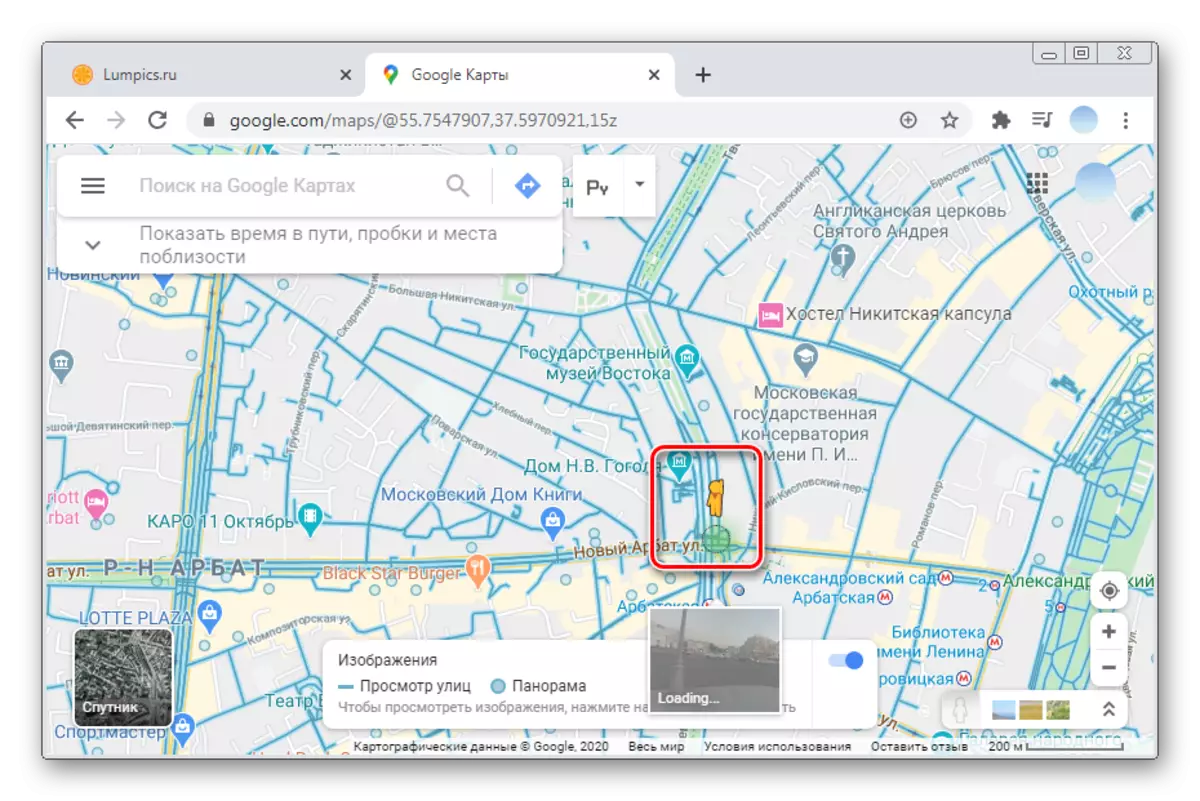
- To select an object, click on the yellow figure and holding the left mouse button, drag it to the desired place.
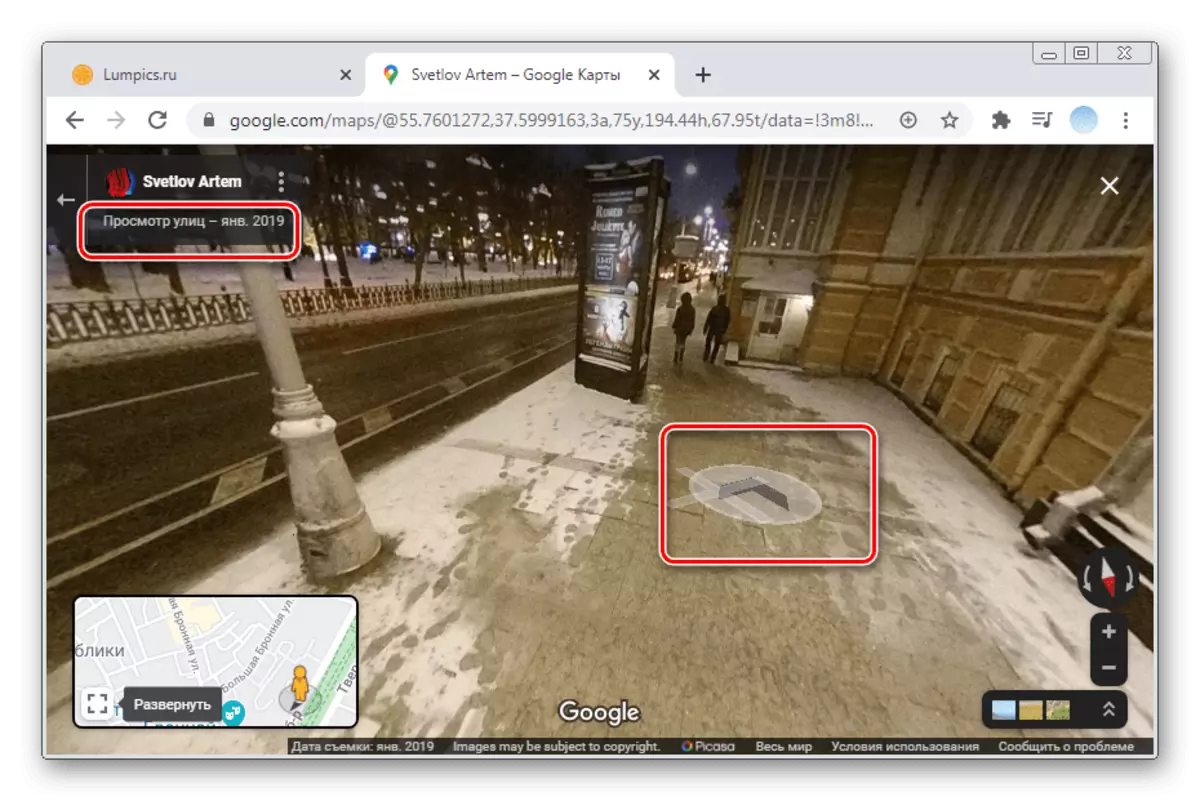
- Set the little man everywhere where there is a blue mark.
- This includes panoramic mode.
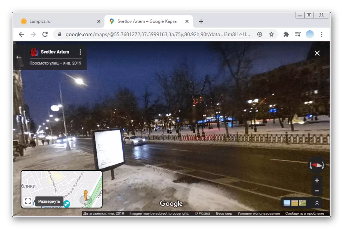
- In the upper left corner, you can see the date of creation of the panorama, and with the help of arrows - to move on the map.


Panoramic photos
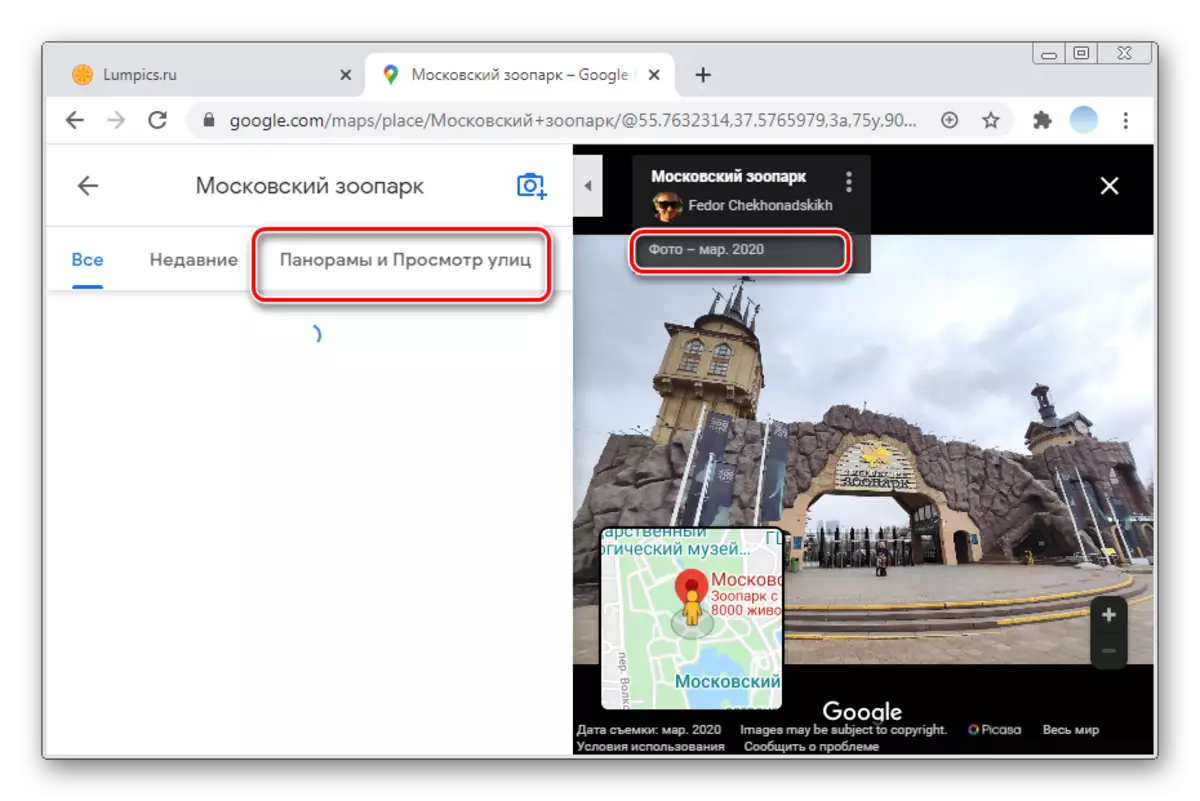
In some cases, viewing panoramic photos made by people in a different period of time, can give more information than a simple card. If you do not find the "Panorama" item when searching for pictures of a certain place, then no one has loaded them.
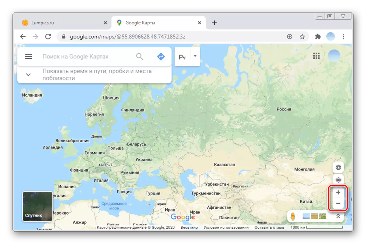
- Using the "+" and "-" buttons, scaling the card to the region that interests you.
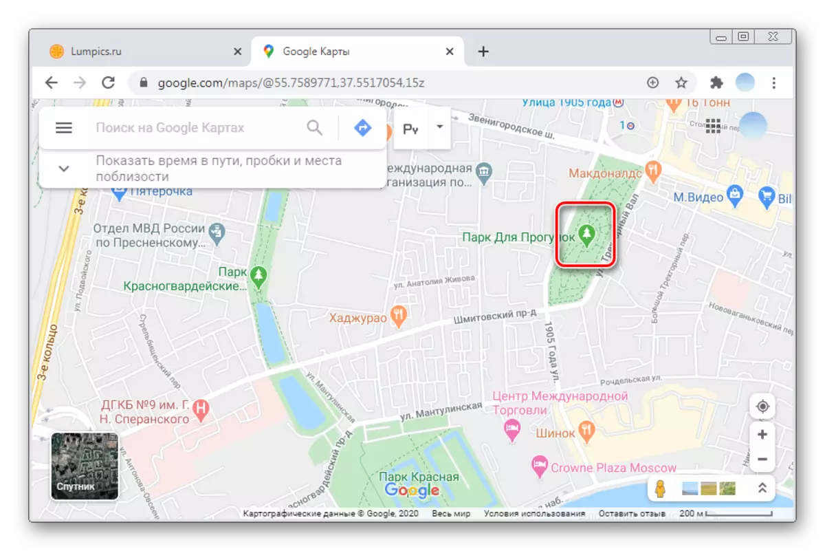
- Click on the icon next to the desired object. If the required location has no icon, click on any place on the map.
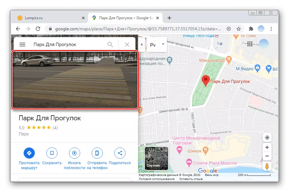
- On the left side will open additional information about the point. Choose the main photo.
- In the gallery, go to the "Panoramas and Street View" section. If this section is empty, you can try to search for panoramic shots from neighboring buildings or objects. Each photo indicates the author and date of shooting.
Option 2: Mobile Applications
Google's branded mobile applications for iOS and Android are fundamentally different. In connection with this, consider each option separately.iOS.
The standard application of Google Cards to view the streets of the streets from smartphones based on IOS is not suitable. Owners of the iPhonov are recommended to install an additional program "View streets" from Google. With it, it is possible not only to walk freely in the selected area, but also see photos of other users.
Download Streets from Google from App Store
- Open the Street View application and select the Region of interest. Card management is carried out in the same way as in the standard Google card application.
- Scaling the map to the required point. In large cities of possible places for panoramic mode, much more than in small villages, not to mention the villages.
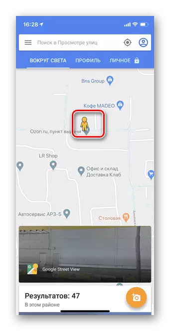
- With increasing card, a yellow figure will appear. To start viewing the Panorama of the Street, transfer it to the desired area. To do this, tap the desired point with your finger and hold within 2-3 seconds.
- Tap to the bottom block "View Streets".
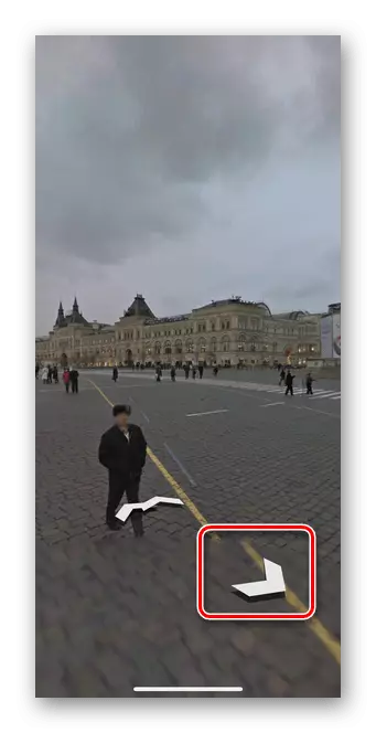
- With the help of arrows, you can move around the map, and the movement of the picture to the right or left allows you to view the surroundings.
Panoramic photos
Panoramic photos make it possible to study the selected object or place in different periods of time. Snapshots are added directly by users. You can find such a panorama and through the Appendix Google Card, and through an additional application viewing streets. In the instructions, consider the first option.
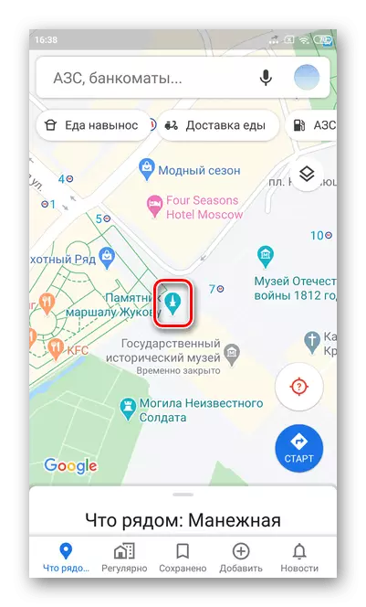
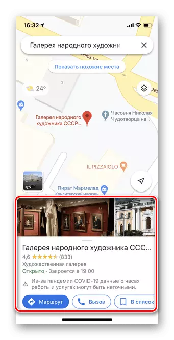
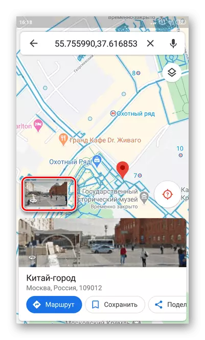
- Open the Google Card application to view panoramic photos.
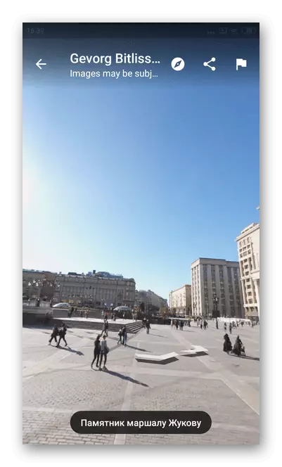
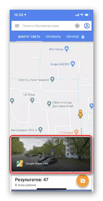
- Choose an object or street, the snapshot of which would like to see. To do this, simply tap the icon, as in the screenshot.
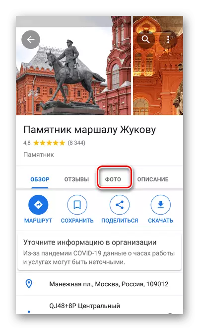
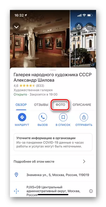
- Information about the place will appear at the bottom. Tap to open a detailed menu.
- Go to the Photos section. Note that there are many objects without photos.
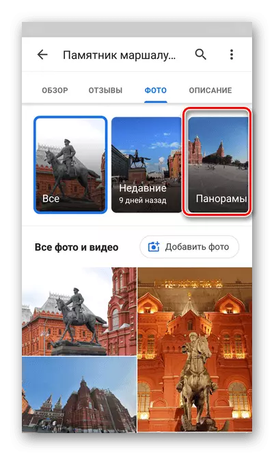
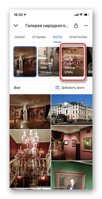
- Click on "Panorama and Street View". If this point is not, it means that no one has not yet uploaded such frames.
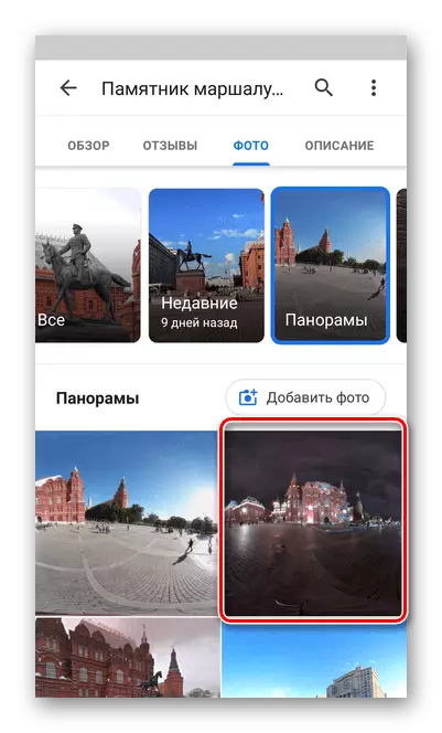
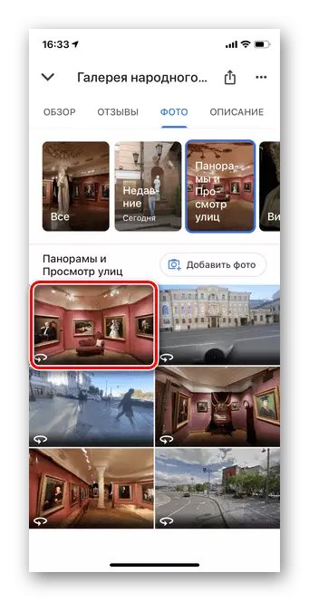
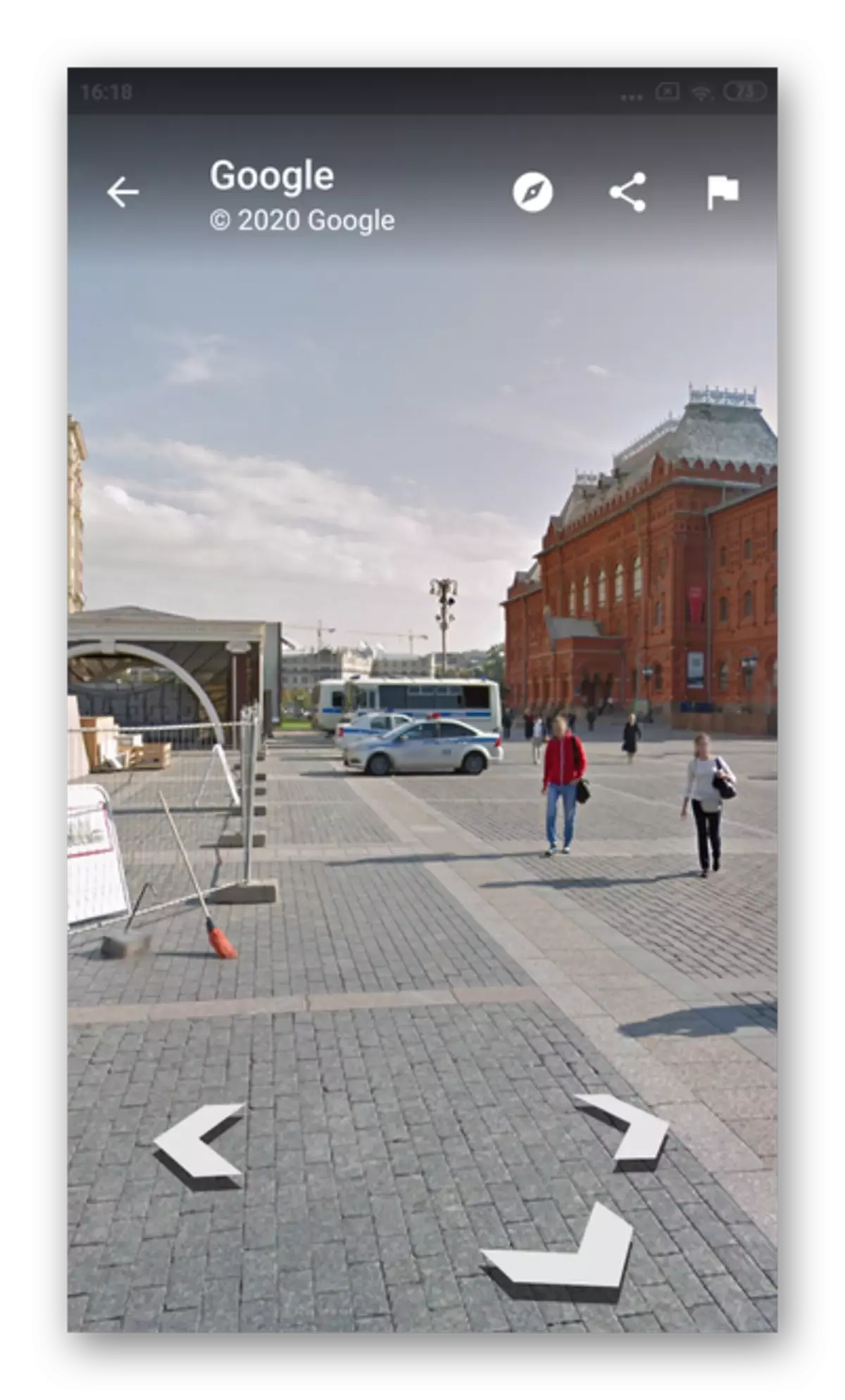
- Choose any panoramic picture.
- By moving the frame to the right or left, you can completely consider the panoramic photo.

Android
Unlike iOS, the Mobile Maps Mobile Maps for Android immediately includes a panoramic mode, the need to additionally download other programs is missing. Please note that some panoramas can be outdated. To update the card database, it is recommended to establish the latest version of Google Maps.
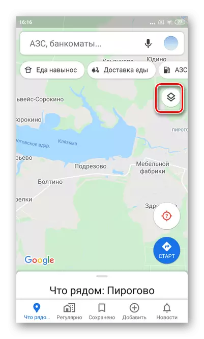
- Open the application and tap on the "Layers" icon, as shown in the screenshot.
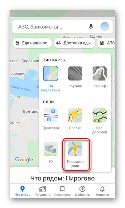
- Select Street View mode.
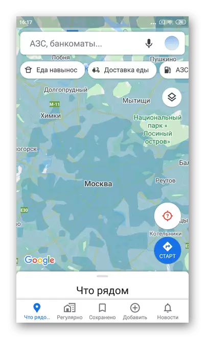
- The appearance of the map will change quite a lot. All territories marked in blue means access to panoramic viewing. Scaling the picture in the area that interests you.
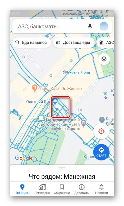
- Touch your finger and hold the street for a few seconds, the panorama of which you want to see.
- Click on the window with the transition to the "Panorama" mode. Also at this stage, additional information about the place appears at the bottom of the screen.
- With the help of arrows, you can move around the map, studying the area.
Panoramic photos
Any user google maps can add and watch photos of any places. The list also has the option of choosing exactly panoramic pictures.
- Open the application and touch any icon on the map. It may be an institution, a monument or just a street.
- Full information on this location will open: name, address, reviews, description and photos. Select the "Photo" section.
- Next, tap "Panoramas". If there is no such option, it means that no one has added panoramic frames of this territory.
- Touch any picture you like. It is recommended to choose newer objects.
- Using the arrows, you can move the photo to any side.